Multiplicity

Multiplicity is a speculative research project that explores the future of urban design through computational methods and multi-objective optimisation, transforming complex urban challenges into actionable, data-driven insights.
lead
differential
location
not applicable
Size
53520m²
Date
2025
Type
Urban research
SCOPE
multi-objective optimization
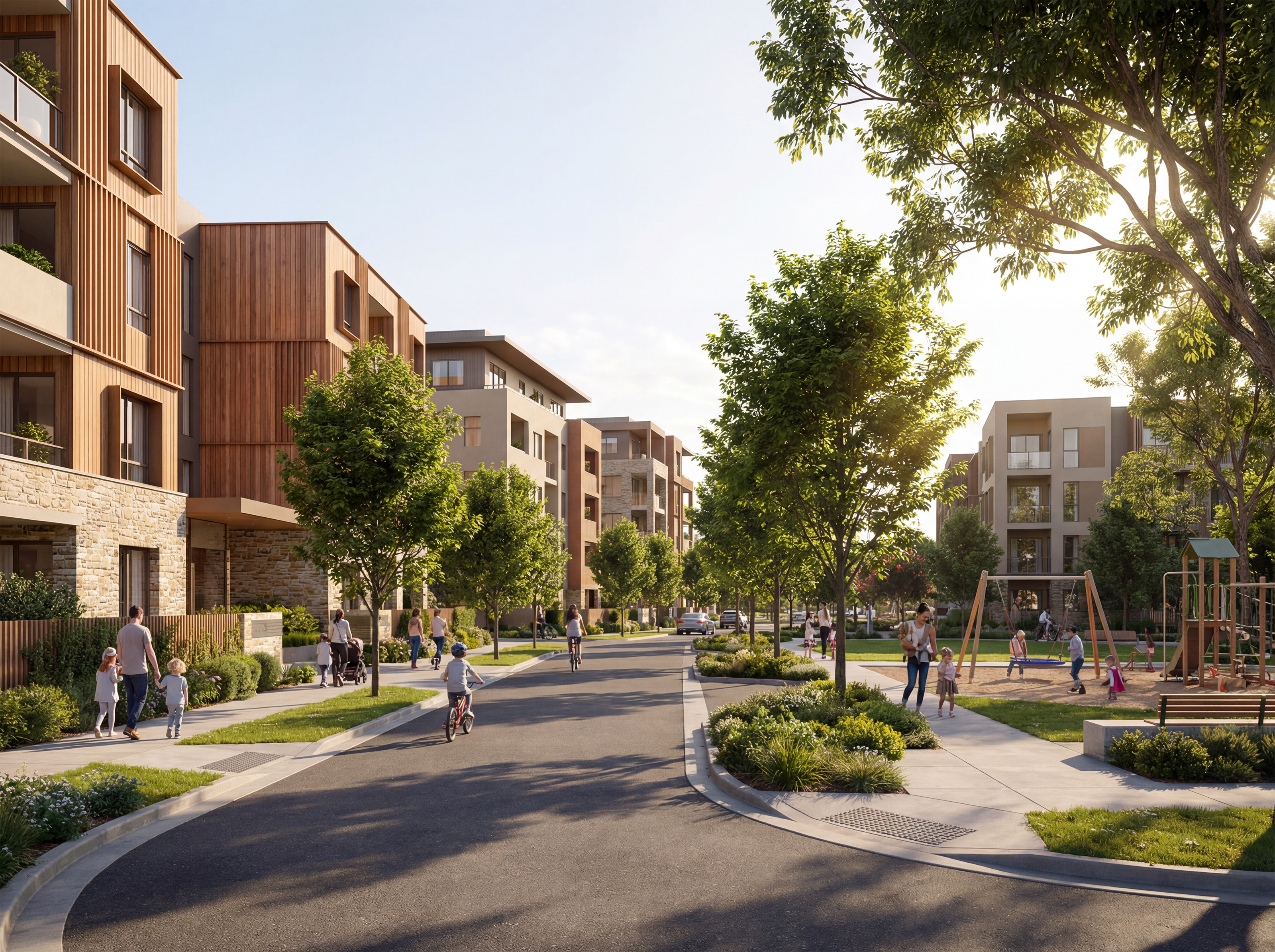
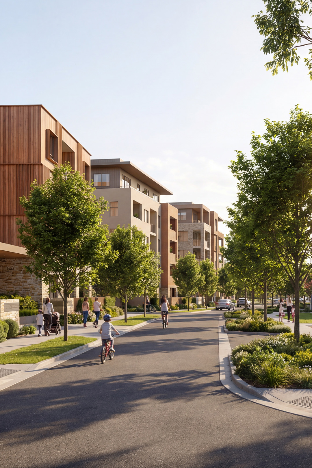
This speculative research project revisited a masterplan conducted seven years ago for 73 plots with a focus on increasing public housing density. Our study explored how multi-objective & computational methods could rapidly test different massing scenarios while balancing equitable access to daylight and views across the site's dynamic terrain.
The previous masterplan provided a benchmark for comparison, while rainflow simulation identified potential flooding risks—expanding evaluation criteria beyond Gross Floor Area alone to include environmental performance and site resilience. Differential designed the multi-objective algorithms and developed a web-based viewer enabling filtering and comparative analysis of solutions.
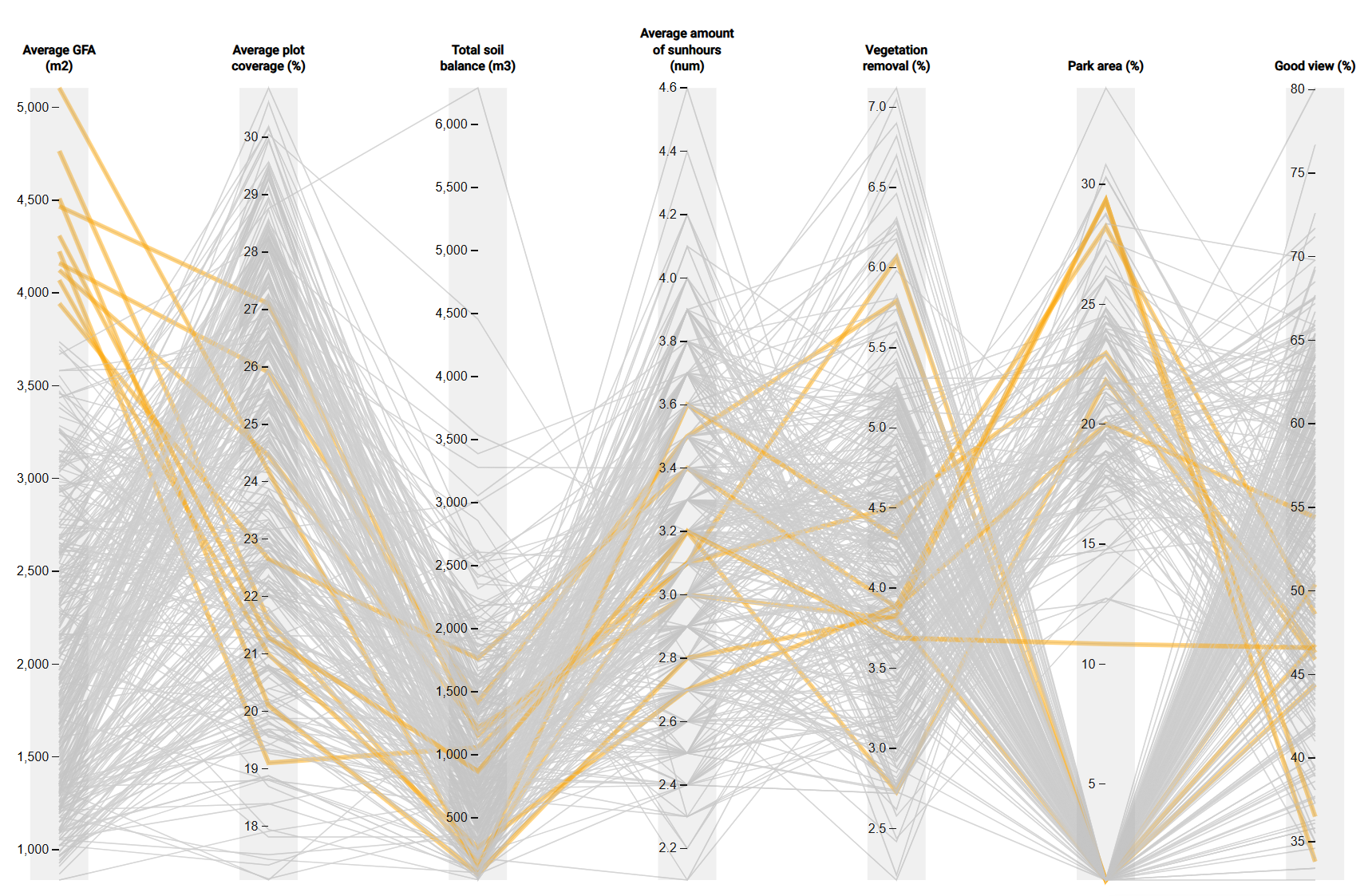
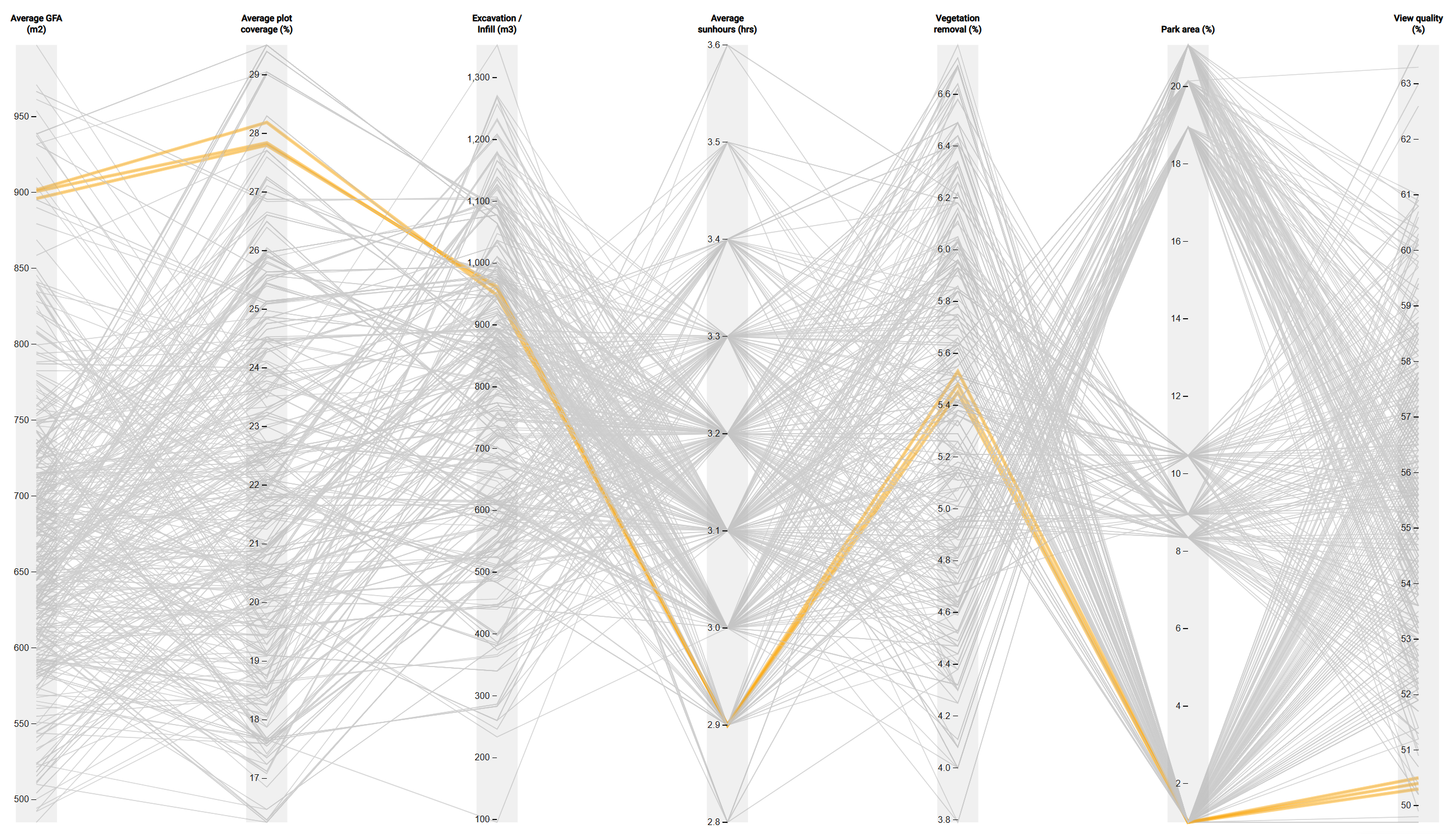
Simulation parameters included average GFA, plot coverage, excavation and infill volumes, direct sun hours, vegetation removal, park area, and view qualities—demonstrating how computational approaches can clarify and inform interwoven design decisions.
Disclaimer: This is a speculative research project exploring computational urban design methodologies. It is not associated with any real development proposal or client. Any recognizable locations or contexts are used solely as test cases for research purposes and bear no relation to actual or proposed projects for those sites.


multi-objective Design & analysis
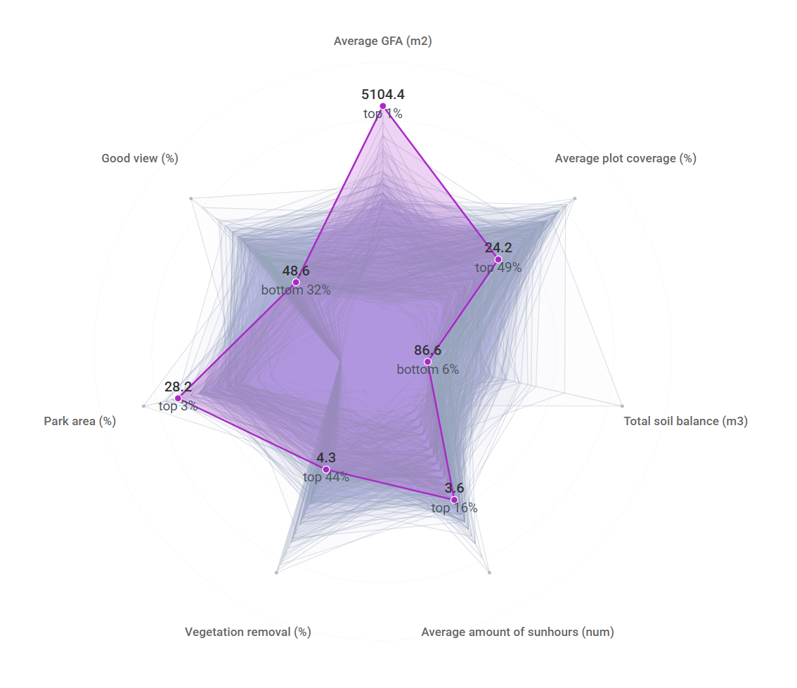
The multi-objective system generated 500 massing configurations, testing performance across multiple design parameters simultaneously. The parallel plot diagram enables filtering and comparison of solutions based on specific criteria.
This approach demonstrates that optimal design is not a single solution but a negotiated balance across parameters—a level of fine-tuning infeasible through traditional design methods. Multi-objective analysis transforms conceptual understanding of trade-offs into quantifiable relationships. For instance, reducing average direct sunlight by 15 minutes yields an average GFA increase to approximately 850m².
plot merging
Since the entire feasibility was written as a holistic parametric system, we were also able to test various plot-merging scenarios across the 73 parcels revealing that a range of strategic merges had the potential of increasing the GFA to over 5000m2 while maintaining similar levels of daylight and views as the discrete plot study.